If you need to know how fast a glacier is flowing across an entire region, satellites are your best tool. If you need to know exactly how much ice a single glacier gained or lost this year, you probably need boots on the ice. That, in essence, is the central trade-off in glacier monitoring: ground-based glaciological surveys deliver precise, direct measurements at a handful of points, while satellite methods—optical feature tracking and Interferometric SAR—deliver wide coverage and frequent revisit capability at the cost of working indirectly from imagery. Here is how the three main methods compare, and how to pick one.
1. Ground-Based Glaciological Surveys: Precision at a Point
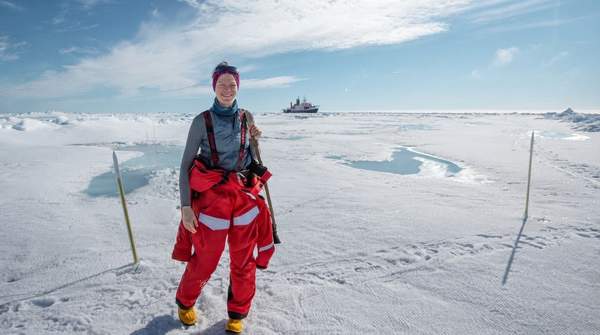
The traditional glaciological method is built on fieldwork. Researchers measure mass balance—the balance of accumulation and ablation—using snow pits and ablation stakes, and track ice motion by installing stakes in the glacier surface and following their displacement with GPS over time. Ice thickness can be measured over time to determine changes in mass balance, as satellite-monitoring documentation on eoPortal explains, and the U.S. National Park Service describes ground-penetrating radar as part of the field toolkit for thickness work.
The catch is coverage and effort. As AntarcticGlaciers.org notes, the stake-and-GPS approach "only yields data for a limited number of points on the glacier surface, and is typically constrained to accessible parts of the glacier so lack the spatial coverage necessary to capture glacier-wide variability." It is also bounded by the length of the fieldwork campaign or equipment lifetime. Field visits for mass balance are typically conducted biannually—one at the end of the accumulation season, one at the end of the ablation season, per guidance the National Park Service credits to standard glaciological references—with extra visits needed to replace stakes where summer melt exceeds several meters. The Park Service characterizes the glaciological method as a technique of moderate cost requiring a high level of specialized training and equipment.
2. Satellite Optical Feature Tracking: Broad Velocity Mapping
Optical feature tracking, also called offset tracking, works by comparing high-resolution satellite images taken at different times and measuring how surface features—crevasses, debris patterns, flowlines—have shifted. It turns a pair of images into a velocity map spanning an entire glacier, ice stream, or mountain range. Sensors like Landsat, ASTER, and Sentinel-2 supply the imagery, and a comparative study hosted by the Arctic Portal's library identifies Sentinel-2 and Landsat-8/9 as popular optical constellations for polar studies, offering high spatial resolution with relatively short revisit time, wide swath width, and free accessibility. That combination of broad coverage, frequent repeat observations, and no data cost makes optical tracking well suited to building long-term velocity time series.
Two constraints temper that appeal. First, optical imagery needs daylight and a clear view of the surface, so cloud cover can interrupt the record. Second, the method depends on distinct surface features to track; smooth, featureless ice resists it. And while coverage is wide at regional scales, contributors writing in Eos caution that limited spatial coverage remains a challenge in complex terrain—for smaller glaciers, fine topography can still fall between the method's effective limits.
3. Interferometric SAR (InSAR): High-Precision Flow, Day or Night
Interferometric SAR takes a different route to the same velocity question. Instead of matching visible features, it compares pairs of radar images—taken, in the ERS-1/2 example documented by eoPortal, 24 hours apart—to measure the phase differences produced by ice motion between passes. Because radar provides its own illumination and penetrates cloud, InSAR works independently of daylight and weather, and it excels at detecting subtle changes in ice flow and surface deformation that coarser methods might miss. In the Antarctic and beyond, InSAR-derived flow measurements, combined with laser altimetry, have revealed widespread dynamic thinning spreading from fast-flowing outlet glaciers far into the interior of the ice sheet, as AntarcticGlaciers.org describes.
The trade-off is on the processing side. InSAR data are more complex to handle than optical offsets, and the technique's precision depends on image pairs acquired under closely matched geometric conditions. The general capabilities described here reflect how these technologies have been used in practice, not an exhaustive survey of every radar mission or processing workflow.
Comparative Overview of Glacier Monitoring Methods
The table below contrasts the three methods across five dimensions drawn from the monitoring literature: what each measures, over what area, how often, at what qualitative cost, and where each falls short. Read down a column to see each method's full profile; read across a row to compare on a single criterion.
| Methodology | Primary Measurement | Spatial Coverage | Temporal Frequency | Qualitative Cost | Key Limitation |
|---|---|---|---|---|---|
| Ground-based glaciological surveys | Mass balance (accumulation/ablation via pits and stakes); point velocity via GPS stakes; thickness via ground-penetrating radar | Limited to a small number of accessible points; cannot capture glacier-wide variability | Typically biannual mass balance visits; stake velocity bounded by campaign length and equipment lifetime | Moderate cost, high training and equipment demands | Logistically intensive; inaccessible terrain and undersampled regions left out |
| Satellite optical feature tracking | Surface velocity from displacement of trackable surface features between image pairs | Broad, glacier-to-regional scale, thanks to wide swath width | High revisit frequency from Sentinel-2 and Landsat-8/9, supporting velocity time series | Free data accessibility | Needs daylight, clear skies, and distinct surface features; complex terrain challenges smaller glaciers |
| Interferometric SAR (InSAR) | Ice flow rate and subtle surface deformation from phase differences between paired radar images | Extensive, demonstrated at ice-sheet scale | Image pairs can be closely spaced (the ERS-1/2 example used a 24-hour interval) | Not specified in the sources; data processing is complex | Complex processing; depends on well-matched image-pair geometry |
The pattern the comparison reveals is straightforward: ground methods buy precision and directness with coverage; optical satellites buy coverage and frequency with a dependence on clear, feature-rich imagery; InSAR buys all-weather precision with processing complexity.
4. Choosing the Right Method for Your Research Question
Start with the variable, not the instrument. If your question is about mass balance—how much ice a glacier gained or lost, and what that means for seasonal water accumulation, storage, and loss in the region—ground-based measurements are the direct answer, and their point-based nature is a feature, not a bug, for single-glacier studies. The National Park Service notes that mass balance monitoring provides a seasonal measure of water accumulation, storage, and loss useful for extrapolating to the wider glacier population of a region. But if you want regional mass-change trends, the in-situ record can mislead: contributors to Eos warn that because of the limited spatial coverage of in-situ observations, the long-term trends they indicate may not accurately represent mass change across entire glacierized regions, some of which remain critically undersampled.
If your question is about flow—how quickly mass is redistributed, and whether a glacier is advancing or retreating—remote sensing comes into its own. Glacier velocity responds to temperature and precipitation in well-documented ways, the Park Service explains, so a velocity time series is itself a climate signal. Optical feature tracking suits long-term, wide-area velocity monitoring where free Sentinel-2 or Landsat imagery can be revisited frequently; InSAR suits studies needing fine sensitivity to subtle flow changes or work in cloudy, polar-night conditions.
Selecting Your Glacier Monitoring Strategy
Researchers should select a glacier monitoring method by first defining their primary research question: whether it focuses on detailed local mass balance and thickness changes, or broad-area surface velocity and deformation. The decisive test is whether the chosen method's data output—point measurements, velocity maps, or deformation fields—directly addresses the specific glacier property and spatial and temporal scale the research question demands. If your design requires glacier-wide coverage or a continuous velocity record, and the data it yields can't deliver that, you have chosen the wrong method; if a single stake network answers your mass-balance question, the satellite's regional sweep is unnecessary overhead. Match the output to the question first, then let coverage, frequency, and cost settle the tie.